Geography
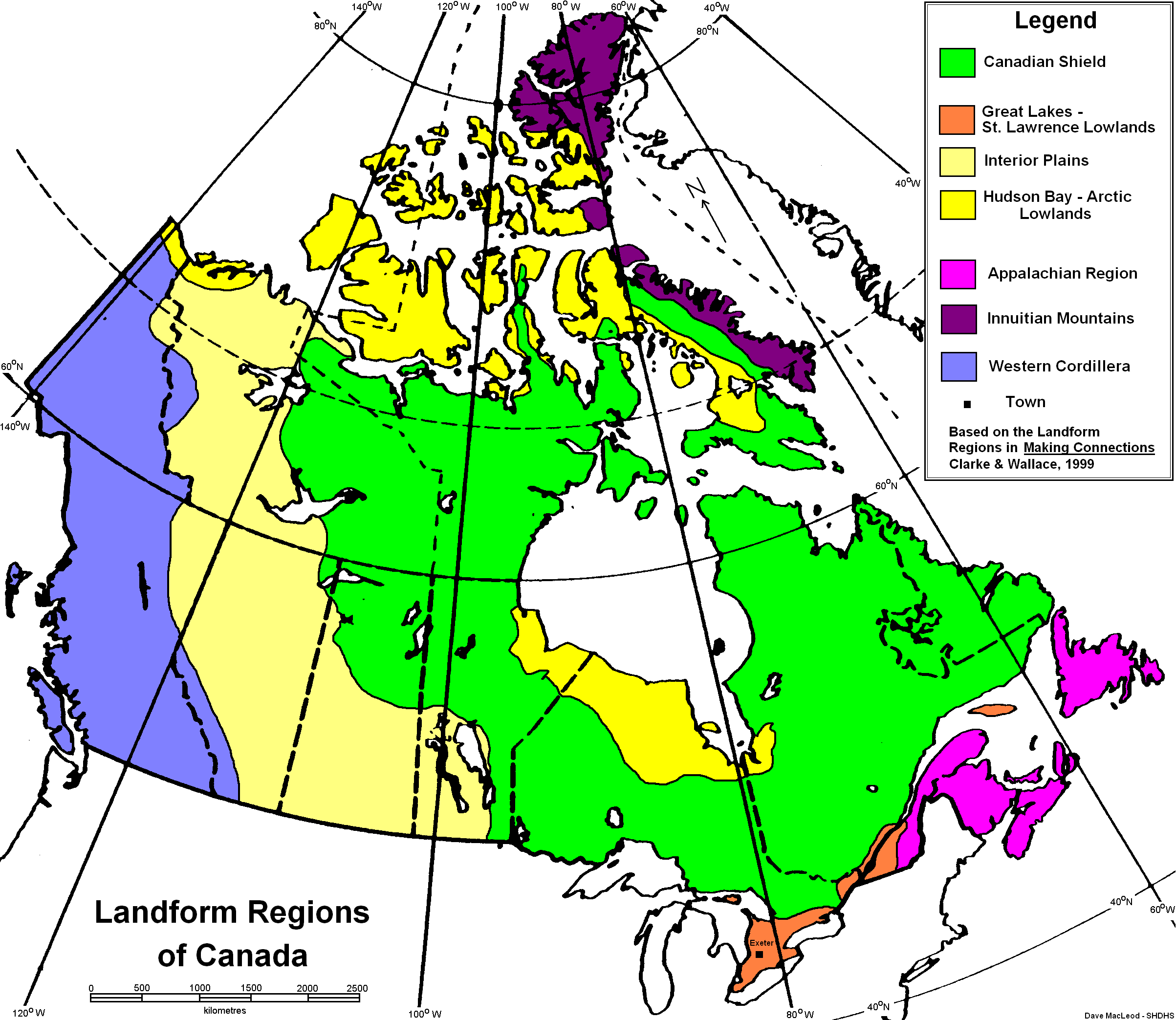
The Interior Plains is represented by the light yellow-taupe colour next to the blue Cordillera.
The Interior Plains is distinguished by its vast expanses of sedimentary bedrock and very flat land that stretches for kilometers. The small-scale features are a result of Quaternary Glaciation, which is 2.6 million to 10 000 years of age. The topography is partly from flat-lying limestones and shales or marine origin underlying the entire region. Erosion and uneven uplift has resulted in the carving of the western part into isolated uplands.
Climate
There are extreme differences in temperature between day and night, and the seasons. The average winter temperature is -15 degrees Celsius to -26 degrees throughout the region, and the average summer temperature is 15 degrees Celsius. The region can experience extreme weather conditions such as extremely cold winters due to being so far away from the ocean, where the climate would be regulated. The area does not get enough rain for a large diversity of crops, and they can get very powerful storms. Although the Rocky Mountains block most of the rain, agriculture can still thrive in the vertisolic soils.

Calgary Climate Graph
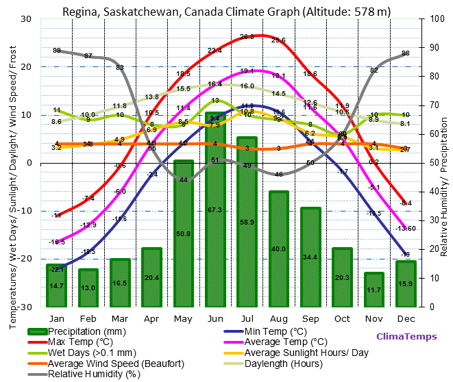
Regina Climate Graph
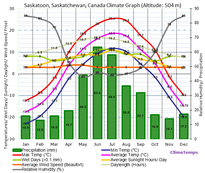
Saskatoon Climate Graph
Flora and Fauna
There is a greater diversity of plants on the Eastern side however the whole region contains many variety. Some are prairie sage, saskatoon berries, spear grass, wheat grass and willow trees.

Willow Tree
Human Geography
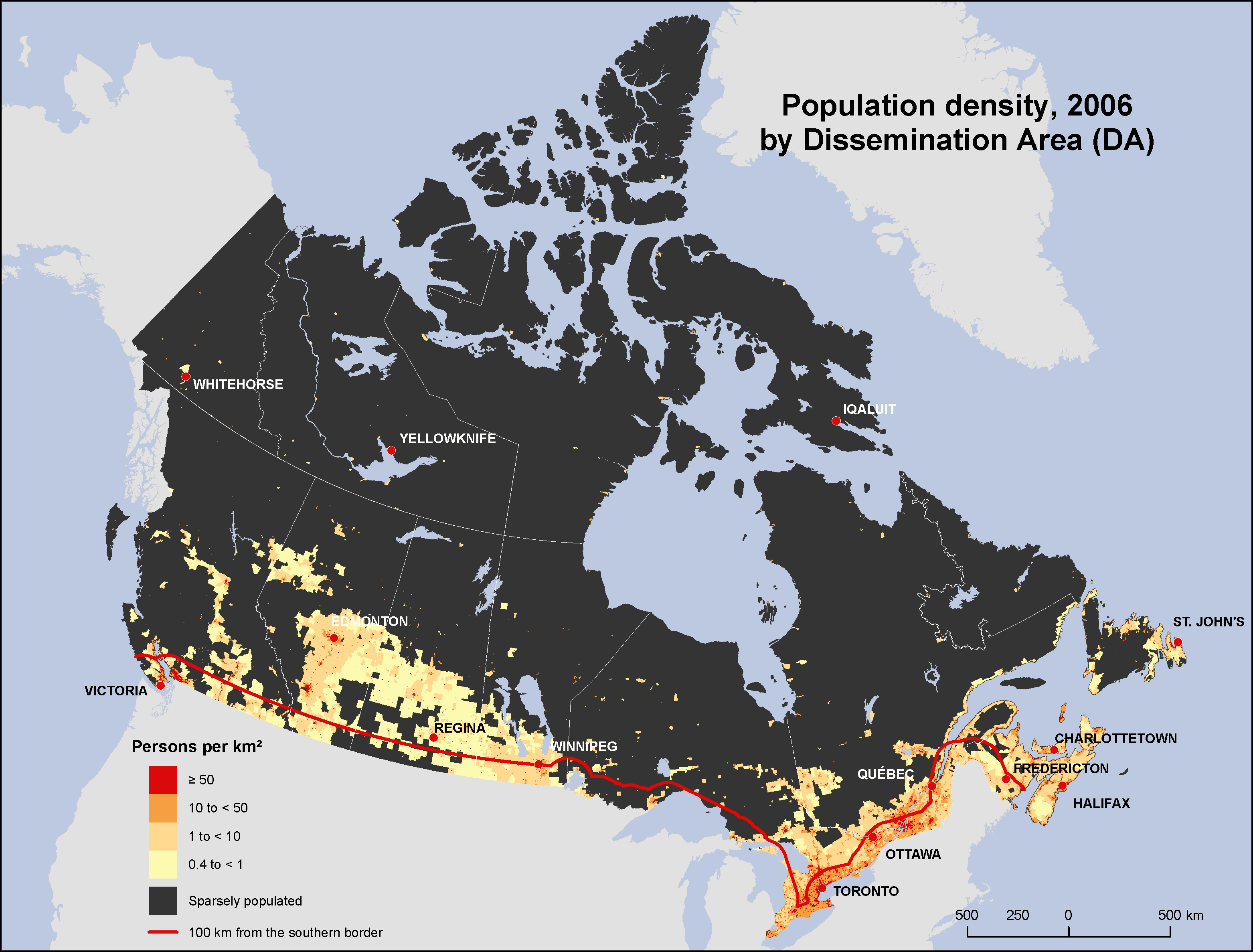
Population Density of Canada
Economy
The past economics of the region were largely based off of the Fur Trade, Bison Hunt and agriculture. Agriculture is still a large part of the economy and farmers grow canola, beans, carrots, wheat and barely, as well as many others. However, since the opeing of the Leduc Oil Field in 1947, the petroluem industry has been dominating. Some of the large companies in the area are Petro-Canada and Husky Oil. The oil sands have also been a large contributer, specifically the ones near Fort McMurray.
Environmental Concerns
A porblem that has come to light in Saskatchewan is the use of pesticides, and how they are linked to serious health conditions. Pesticides are used in farming, in cities and in personal gardens, however people may not know that there are links between pesticides and solid tumors, brain cancer, prostate cancer, kidney cancer, pancreatic cancer, leukemia and nervous system damage. Not to mention the environment damage pesticides cause, getting rid of "pests" also contaminates soil, water and air. The best way to eliminate this problem is to stop the use of pesticides and being okay with eating a grape with a hole in it, or a potato with a few pecks.
Comparison
Calgary Climate Graph

Temperature Graph of Sochi

Precipitation Graph of Sochi
No comments:
Post a Comment