Geography
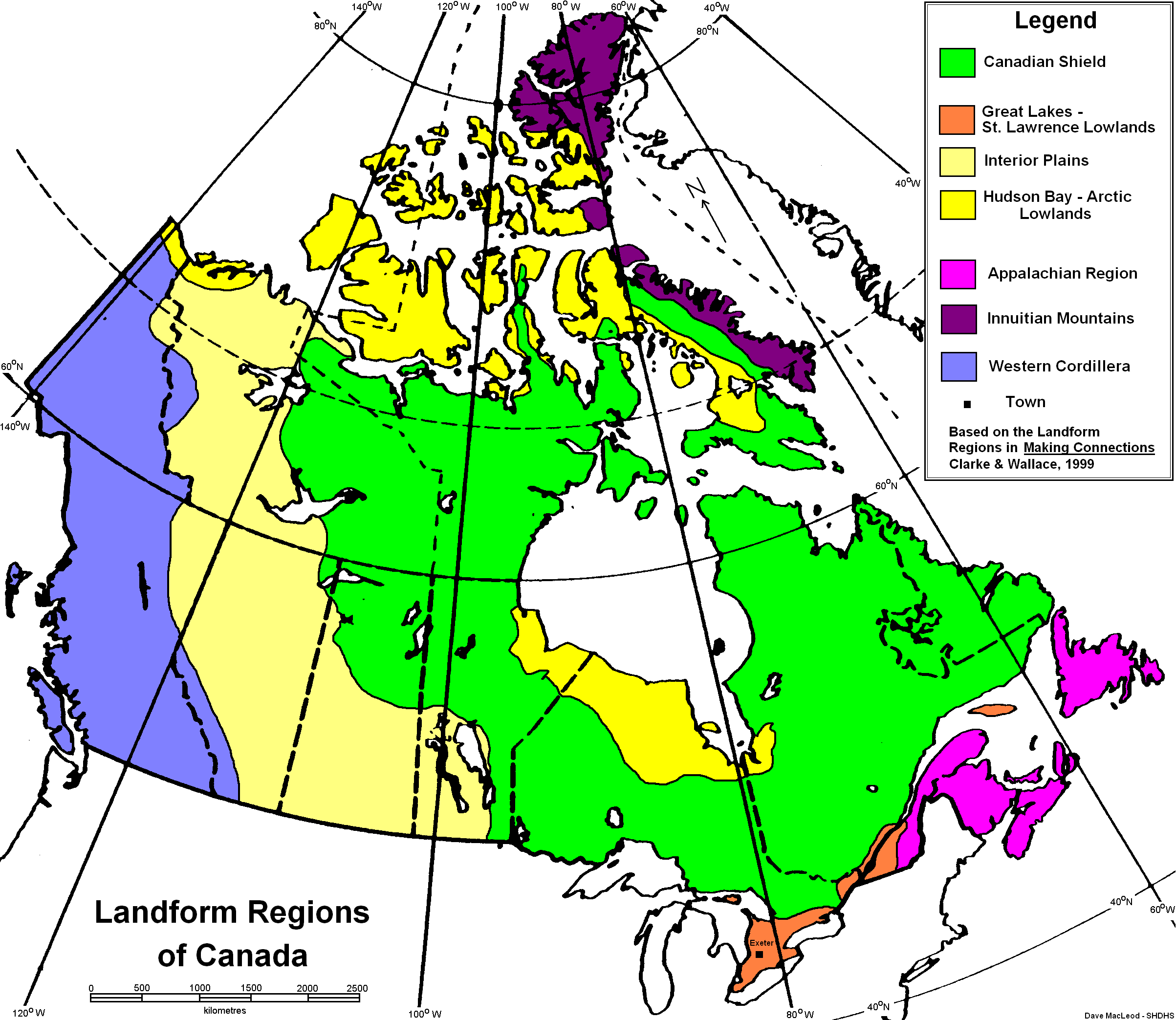
The Canadian Shield is represented by the neon green colour covering most of Canada.
The Canadian Shield covers five million square kilometres. It is made up of pieces of the Earth's crust which began colliding together more than three billion years ago through plate tectonics. Repeated glacial advancements have left many lakes, streams, rivers and ponds, such as Great Bear Lake, Great Slave Lake, Lake Athabasca and many more. Some of the areas oldest rocks were found near Great Bear Lake.
Climate
Due to the large size of the Shield, the climate varies depending on which area you are in. In the southern parts they have a seasonal climate with an average winter temperature of -18 degrees Celsius, and an average summer temperature of 25 degrees Celsius. In the northern region, there is an average winter temperature of -35 degrees Celsius, and an average summer temperature of 15 degrees Celsius. Precipitation can range anywhere from 400 mm a year to 1600 mm a year, depending on position to large water bodies.
The lowlands have soggy soil that it suitable for planting trees and there are many marshes and bogs. However, the rest of the region has very coarse soil that does not hold moisture well and is frozen year-round.
Climate change will effect the region by increasing how many forest fire there are, increasing the already one million hectares to three million hectares.

Thunder Bay, Ontario Climate graph

Cambridge Bay, Nunavut Climate graph

Iqualuit, Nunavut Climate graph
Flora and Fauna
In the south, the Canadian Shield is a vast boreal forest containing many trees such as white spruce, black spruce, balsam fir, balsam poplar, red pine and white pine. The animals of the southern range from large herbivores specifically, caribou, deer and moose to large carnivores for example, bears, lynx, bobcats and wolves. Small animals like squirrels, chipmunks, hares, beavers and porcupines are also present, as well as, whales and seals off the east coast.

Moose

Canadian Shield Boreal Forest
The transition between between the tundra and boreal forest is called the Northern Canadian Shield Taiga eco-region and it is characterized by low lying bushes. The bushes are very low because of the harsh winds keeping them low to the ground.
Human Geography
Since the northern region of the Canadian Shield has gruelling conditions, people tend to stick to the southern areas where it is warmer. There are 2 people per square kilometre in the cities and less than 0.5 people per square kilometre everywhere else. Inhabitants use the land for forestry, mining, hydroelectric power and recreational sources. Some of the major cities in the lower region are Sudbury, Chicoutimi and St. John's. In the Taiga, the major cities are Yellowknife, Labrador City and Churchill Falls.

Population density map of Canada.
Economy


Moscow climate graph

Yellowknife climate graph
Canada's largest economic region is the Canadian Shield, as it covers most of Canada's land. In the past, the most dominant economics activity was the fur trade. Forestry was large as well as mining, which are both still prevalent today.
Many mines are stationed in the region, accompanying many mining companies that started up in the region. Some elements that are largely mined are, aluminium, iron, nickel, copper and silver. Two global mining companies that are recognized worldwide are Inco and Alcan.
Inco mining company logo
Alcan mining company logo
The Shield's many rivers also opened up the opportunity for hydroelectric power, which soon developed after Confederation.
Environmental Concerns
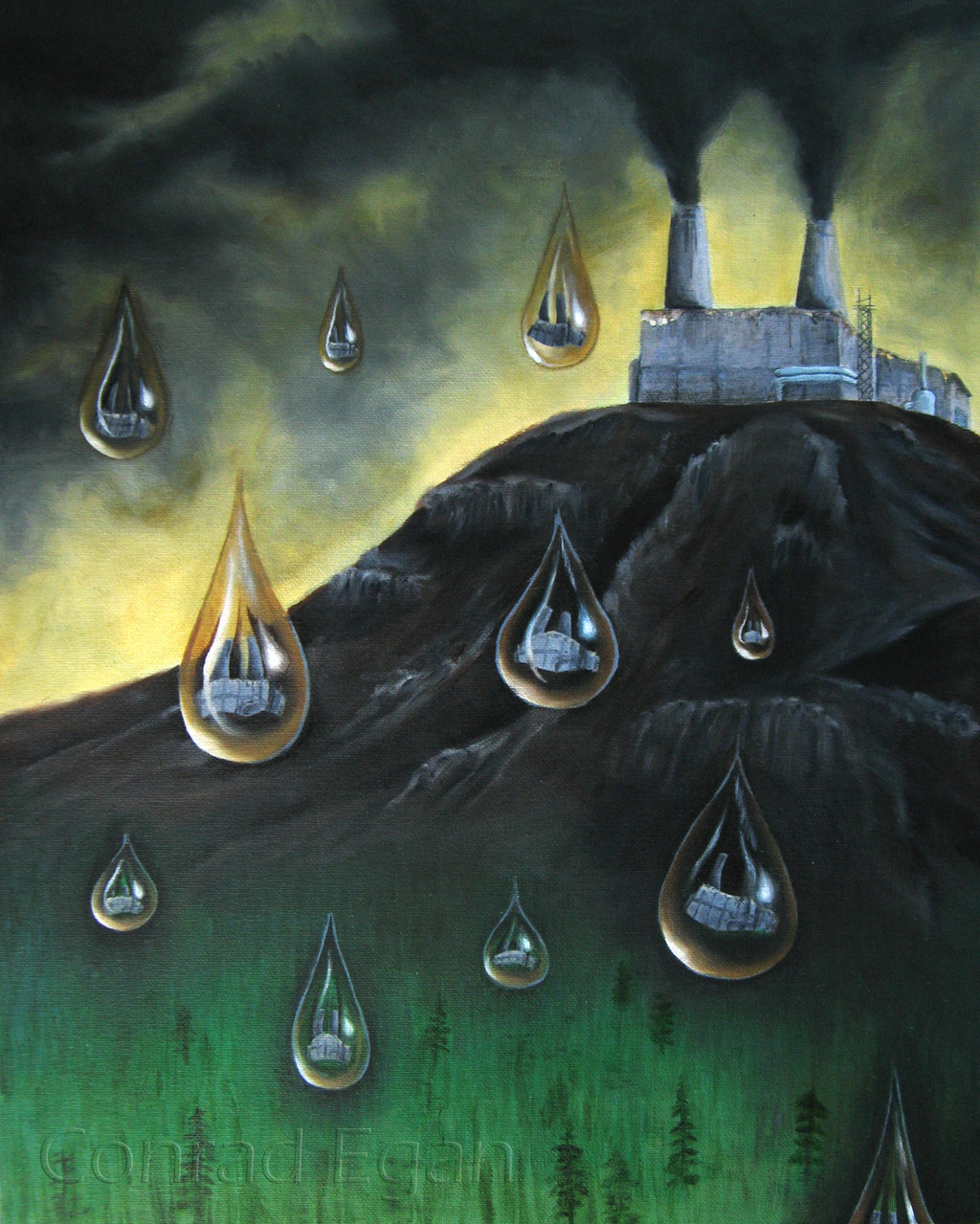
A large problem for most of Eastern Canada is Acid rain, and it is now a problem in the Canadian Shield.
As emissions of sulphur dioxide and nitrogen oxides transform into secondary pollutants, they are removed from the atmosphere (their presence makes the pH scale of the acids in it over 5.6) in the form of rain, snow, steel or hail.
This is a problem in the Canadian Shield because the lakes and rivers lack natural alkalinity, and therefore cannot neutralize the water naturally as some other regions can. One way of stopping the fall of acid rain is to reduce emissions of the toxins that cause it. This has been the solution for many environmental problems, however most of the population is not open to the idea since it is so integrated into society.
Illustration of acid rain
Comparison
One comparison is that between Moscow and Yellowknife. Although Moscow receives more precipitation, they have very similar maximum temperature, number of wet days, humidity and minimum temperature. In Moscow, women make up more than half of the work force. Major industries are, engineering, manufacturing, food processing and furniture making. Some of Moscow's major exports are, metals, wood and oil.
Moscow climate graph
Yellowknife climate graph
No comments:
Post a Comment